

Aerial Surveying
Mapping
Drones are invaluable for mapping, delivering high-resolution imagery and precise data for accurate cartography quickly and efficiently.
Equipped with advanced sensors, drones create detailed topographical maps and 3D models, ideal for urban planning, agriculture, construction, and environmental monitoring. Their aerial advantage allows access to remote or hard-to-reach areas, where traditional surveys are too slow or risky. Drones streamline data collection, cut labor costs, and enhance map accuracy while speeding up the entire process.

3D Modelling
Using drone-captured imagery and photogrammetry, we can generate precise digital models of terrain, structures, and assets. These models allow for efficient volume calculations, topographic mapping, and construction planning, all without the need for prolonged on-site measurements. The result is faster data collection, improved accuracy, and better-informed decisions across industries like construction, agriculture, and infrastructure development.
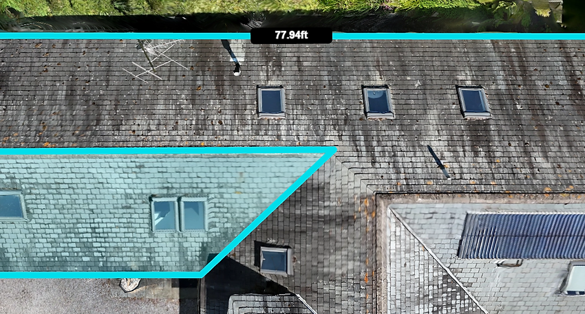
Accurate Dimensions
Our datasets provide accurate measurements of distance, area, elevation, and volume, often to within centimeters, making them ideal for land assessments, construction planning, and environmental monitoring.
Compared to traditional ground-based methods, drone surveys are safer, faster, and more cost-effective, without compromising on accuracy.
_edited.jpg)
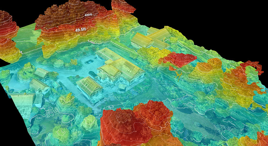
Elevation Models
By capturing overlapping aerial images and applying photogrammetry or LiDAR technology, drones produce detailed digital elevation models (DEMs) and contour maps.
These models provide precise height data, revealing changes in terrain, slope gradients, and elevation points. Ideal for site planning, flood risk analysis, and civil engineering, drone-based elevation surveys reduce the need for manual levelling, offer faster turnaround times, and cover large or challenging areas with ease and precision.


